

Experience
2023 — Present
GIS Specialist
Small Business Administration
Lead geospatial information services analyst, visual designer, and key advisor to the Director of Data Analytics and Information Technology in the Office of Disaster Recovery and Resilience.
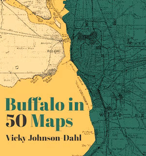
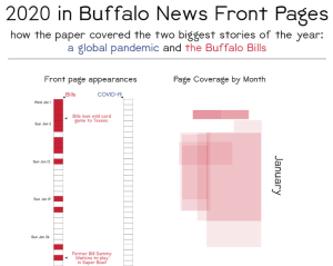
Buffalo, NY
2019-2023
Senior Geographic Information Officer
Macfadden PAE & WWC Global/USAID Office of Transition Initiatives
Expert in cartography, data analysis, information visualization, and project management for the USAID Office of Transition Initiatives (OTI) in support of conflict prevention and stabilization.
Washington, DC
2017-2019
Senior Geographic Information Officer
Macfadden/USAID Office of Food for Peace
Provided GIS, cartographic, and graphic design expertise to the USAID Office of Food For Peace (FFP) in support of humanitarian missions worldwide.
Washington, DC
2012-2017
GIS Analyst & Cartographer
Macfadden/USAID Office of Afghanistan and Pakistan Affairs
Provided GIS, data, and cartographic services to the USAID Office of Afghanistan and Pakistan Affairs (OAPA) and coordinated with field-based staff to provide continuous coverage in a demanding, high-pressure environment.
Washington, DC
2010-2012
Intermediate GIS Analyst
New Light Technologies/US Census Bureau Center for Economic Studies
Designed GIS and human-centered user experience components of Census web-based labor force economic impact mapping and analysis application.
Washington, DC
2009-2010
GIS Technician
ASRC Federal/US Census Bureau Geography Division
Researched, structured and processed raw data into spatially accurate format for inclusion in Census Bureau map products.
Suitland, MD
2008
GIS Operator
Waitakere City Council Parks & GIS Departments
Created maps and leveraged geographic information databases to index assets and provide geospatial solutions to citizen inquiries regarding land parcels.
Waitakere, New Zealand
